
價格:免費
更新日期:2019-06-06
檔案大小:10.9 MB
目前版本:1.0.4
版本需求:需要 iOS 10.0 或以上版本。與 iPad Air、iPad Air Wi-Fi + Cellular、iPad mini 2、iPad mini 2 Wi-Fi + Cellular、iPad Air 2、iPad Air 2 Wi-Fi + Cellular、iPad mini 3、iPad mini 3 Wi-Fi + Cellular、iPad mini 4、iPad mini 4 Wi-Fi + Cellular、12.9 吋 iPad Pro、12.9 吋 iPad Pro Wi-Fi + Cellular、iPad Pro(9.7 吋)、iPad Pro(9.7 吋)Wi-Fi + 行動網路、iPad (第 5 代)、iPad(第五代)Wi-Fi + 行動網路、iPad Pro(12.9 吋)(第二代)、iPad Pro(12.9 吋)(第二代)Wi-Fi + 行動網路、iPad Pro(10.5 吋)、iPad Pro(10.5 吋)Wi-Fi + 行動網路、iPad (第六代)、iPad Wi-Fi + Cellular(第六代)、iPad Pro(11 吋)、iPad Pro(11 吋) Wi-Fi + 行動網路、iPad Pro(12.9 吋)、iPad Pro(12.9 吋)Wi-Fi + 行動網路、iPad mini(第 5 代)、iPad mini(第 5 代)Wi-Fi + 行動網路、iPad Air(第 3 代) 及 iPad Air(第 3 代)Wi-Fi + 行動網路 相容。
支援語言:英語
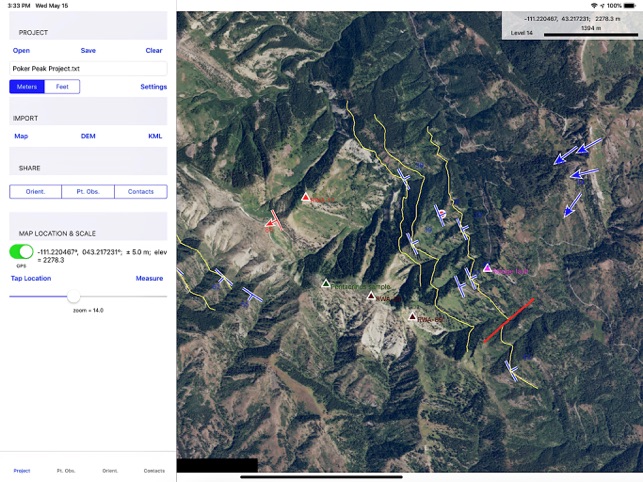
Most mobile device field mapping software is excellent for locating the geologist horizontally (in X and Y, longitude and latitude, etc.) but does not bring the third dimension, elevation (i.e., Z), into the picture. However, to do significant calculations that can aid the geologist while in the field, you need X, Y, and Z.
GMDE Mobile, for iPad only, is one of the first mapping programs to allow the user to load a digital elevation model (DEM) for off-line use in the field. This allows the field geologist to do interesting calculations such as:
• Project a planar contact across topography, giving the mapper an immediate hypothesis to test in the field as well as improving mapping overall by plotting planar contacts exactly as they should cross topography. (see app preview movie, above)
• Calculate orientations from three-point problems, yielding strike and dips that reflect much more accurately the orientation at the map scale rather than the outcrop scale (of course, you can also enter outcrop scale orientations measured with a compass or with the iPad itself).
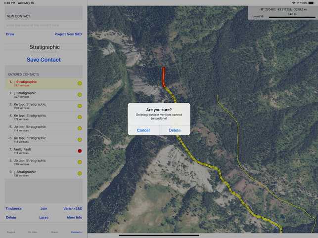
• Calculate a planar orientation by best-fitting a plane to the vertices of a contact drawn on the map.
Determine map thickness of stratigraphic units just by tapping a point on the base and a point on the top of the unit.
• Calculate map stratigraphic thicknesses in the field
• Measure slope angle as well as distance.
GMDE Mobile does a lot of other things, too, including:
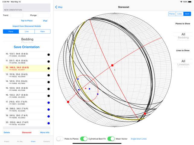
• Use the iPad orientation to measure the orientations of lines and planes, or type (or dictate) your measurements in directly
• Import data collected in Stereonet Mobile on an iPhone to GMDE Mobile on an iPad in the field with nothing more than an active Bluetooth connection between the two devices
• Import of .kml files
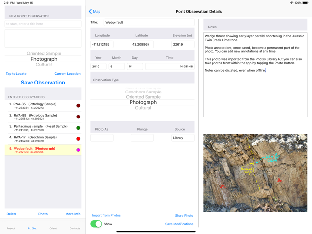
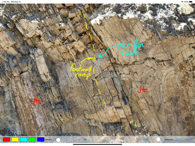
• Capture and annotation of photos from within the app as well as transferring photos to and from your Photos Library
• Stereonet plots of your data
• StraboSpot -- upload your data to your StraboSpot account
• User definable data types, colors, and symbols
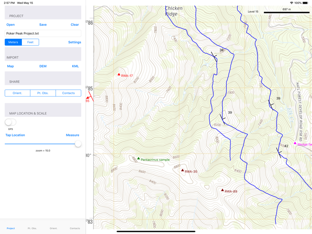
• loading of multiple base maps onto your device
To perform this magic, the user of GMDE Mobile will need to know or have access to the following skills (detailed instructions in the users manual):
•Download GridFloat DEMs of the area in which they are interested.
•Produce base mapping materials (satellite images, topo maps, etc.) in mbtiles format (this version of GMDE Mobile does not enable download of online maps from within the app)
• Upload these large digital files to the iPad using iTunes File Sharing to transfer the digital files to GMDE Mobile’s document folder.
支援平台:iPad